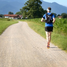
The Vaihingen campus is very suitable for running, jogging and walking due to its location directly at the Pfaffenwald. We offer different running tracks with distances with 2km, 4km, 6km and 15km as well as a half marathon and two Nordic walking tracks. At the campus city center, we offer one Nordic Walking course and two running courses. It doesn’t matter if you want to take a short lap in the lunch break or get your training in after work! On our homepage you will find the track that suits you best!
Notice: The tracks are only recommendations and lead over public roads and paths. There are no barriers and the StVO applies. We are not responsible for the use of the paths.
The small turquoise campus round (2 km)
- Length: 2km
- Altitude: 16m
- Terrain: flat, a small gradient
- Condition: asphalt roads
- Difficulty: easy
This short route leads once anti-clockwise around the southern block of the Vaihingen campus. Always on the wide sidewalks next to the streets. It is mainly flat, with only two short hills. The start is, as with all courses, the square in front of the INSPO buildings. Looking in the direction of the Maths-Physics building, it runs first along the Allmandring, then at the intersection right onto the Pfaffenwaldring, past the "IZ", and then onto the Nobelstrasse. Past the bus stops and at the lowest point of the route turn right back to the "INSPO". The route can be used to add another 2 kilometers to a run or to run several rounds on it. Or if you only have a few minutes and still want to get some exercise.
The large yellow campus round (4 km)
- Length: 4km
- Altitude difference: 35m
- Terrain: flat, one gradient
- Condition: asphalt roads
- Difficulty: easy
This route is similar to the 2km route and also runs along the sidewalks next to the roads, clockwise around the main part of the campus. This includes the slightly longer climb to the northern part of the campus. From the "INSPO", go down to the right and then left onto the "Nobelstrasse". Follow this, across the crosswalk at "Pfaffenwaldring", past the bus stops and after the police turn left again onto "Pfaffenwaldring". Follow this road completely and only at the turn-off after the bridge turn off again onto "Allmandring" and end the round trip at the "INSPO". Like the 2km track, this one is also suitable to add a few more kilometers or to do laps, which is especially useful in the dark, because the whole track is lighted.
The green Büsnauer Wiesental round (6 km)
- Length: 5,7km
- Altitude difference: 100m
- Terrain: hilly
- Condition: asphalted roads, gravel roads
- Difficulty: medium
The route begins on asphalt road and sidewalks from the "INSPO" to the traffic circle down and past the Lauchäcker residential area. From there it goes into the forest, on gravel paths. The route leads past the "Katzenbach Lake" and the "Max Planck Institute" before returning to the "INSPO" via the "Büsnauer Wiesental".
On this route it is always slightly up and down, but not too steep.
The blue Katzenbachsee round (15 km)
- Length: 14.7km
- Altitude: 229m
- Terrain: hilly
- Condition: asphalted roads, gravel roads
- Difficulty: somewhat demanding
Starting at "INSPO", the route first runs through the "Büsnau Wiesental" to the "Max-Planck-Institut". From there through the Büsnau Forest, past the "Katzenbacher Hof", over the "Bernhardshöhe" (Stuttgart's largest elevation) and back again through the "Katzenbach Lake".
The course runs mainly in the forest, so it is also suitable on sunny days, because of the shade. The nature of the paths is about half asphalt and half gravel. There are several steep ramps and slightly longer but flatter ascents, so the course is rather challenging. The "Bernhardshöhe" down is a narrow dirt road, therefore technically demanding.
The red Solitude half-marathon (21,5 km)
- Length: 21,5 km
- Altitude: 373m
- Terrain: hilly
- Condition: asphalted roads, sidewalk, gravel roads, single trail
- Difficulty: demanding
The route is demanding but also very diverse. It runs through woods, meadows and all kinds of paths. The start of the route is at "INSPO". It runs first through the "Büsnauer forest", past the "Katzenbach lake" and the "Katzenbacher Hof". Afterwards a road has to be crossed before continuing through the forest down to "Glemseck". There you have to go through an underpass to the other side of the street, up the hill again to the "Rappenhof" and past it. This is a challenging ascent, sometimes a bit steep, but you will be rewarded with a beautiful view over Leonberg. Then you continue to "Schloss Solitude", partly on a few short single trails, the beginning of which is not quite obvious. From there, the route leads back through the forest to the "Mahdentalstraße", which you cross by means of an underpass. After that, there is a short steep ramp to "Büsnau", where you go through an underpass again and stay on the sidewalk until you reach the "Max-Planck-Institut". Then you go through the "Büsnauer Wiesental" back to the "INSPO". In total there are several longer and shorter ascents and descents. There is no continuous shade, since not the entire route runs through the forest. However, the route is one of the most beautiful longer rounds starting from the university!
Nordic-Walking midday round (2 km)
- Length: 1,9km
- Altitude: 0m
- Terrain: flat
- Condition: asphalt roads
- Difficulty: easy
This round is located in the southern part of the campus, past some of the institutes and therefore easy for employees to integrate during their lunch break. The round runs mainly on asphalt and should take 20-30 minutes
Nordic-Walking campus round (3 km)
- Length: 3,1km
- Altitude: 10m
- Terrain: a little up and down
- Condition: asphalted / paved paths
- Difficulty: easy
This round is located in the center of the campus, making it easily accessible for most employees and students. It passes a few institutes and dormitories, mainly over asphalt and pavement. The lap takes about 40-60 minutes.